
CBSE Class 12 2024 Geography Set -1 (Code: 64/2/1) Question Paper Pdf - Check Solutions with Answer Key Pdf

.jpg?tr=h-55,w-55,c-force)
Content Strategist|Tech-innovator|National Hackathon Winner | Updated On - Jan 28, 2025
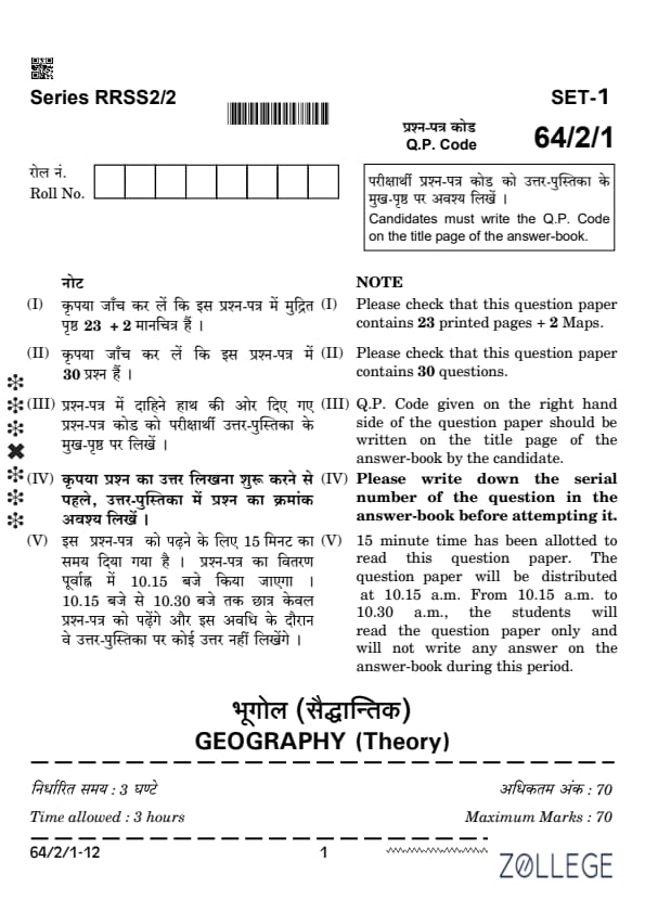
CBSE Class 12 2024 Geography Set 1 Question Paper (Q.P. Code: 64/2/1) is available for download. The exam was successfully conducted by CBSE on February 29 in the morning session from 10:30 AM to 1:30 PM. As per the students’ initial reactions, the CBSE Class 12 2024 Geography Set 1 Question Paper was reported as Moderate. The Human Geography section was considered Easy to Moderate, the India: People and Economy section as Moderate, and the Map Work section as Easy.
CBSE Class 12 2024 Geography (Set 1- 64/2/1) 2024 Answer Key With Solution
Candidates can download the CBSE Class 12 Geography Question Paper with Solution and Answer Key PDFs for Set 1 Question Paper (Code: 64/2/1) using the link below.
| CBSE Class 12 Geography (Set 1- 64/2/1) 2024 Question Paper with Answer Key |  Download Download |
Check Solution |
CBSE Class 12 2024 Geography Question Paper with Solutions
SECTION A
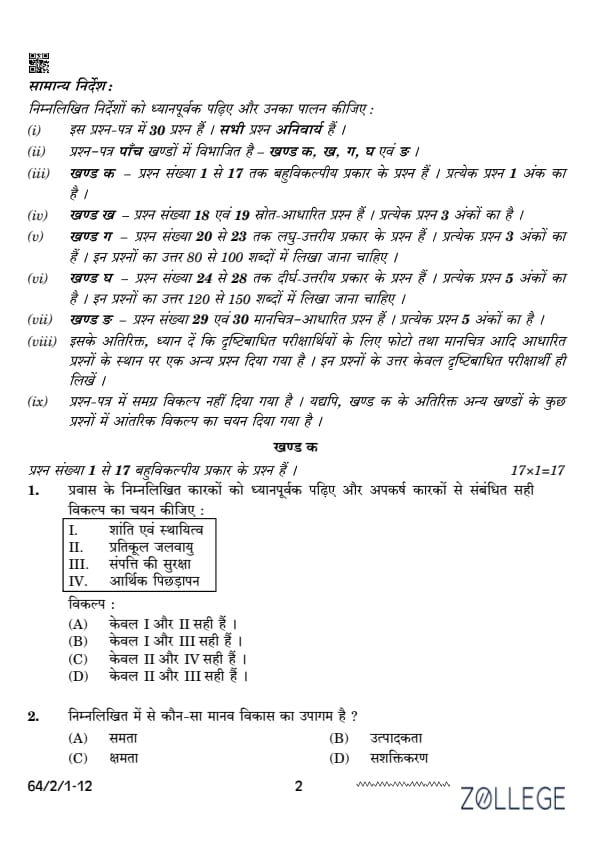
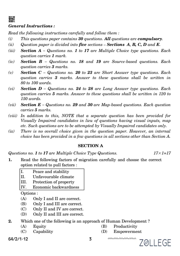
Question 1:
Read the following factors of migration carefully and choose the correct option related to pull factors:
I. Peace and stability
II. Unfavourable climate
III. Protection of property
IV. Economic backwardness
Correct Answer: (B) Only I and III are correct.
View Solution
Pull factors in migration refer to positive conditions that attract individuals to a particular location. Peace and stability (I) and Protection of property (III) are examples of pull factors, while Unfavourable climate (II) and Economic backwardness (IV) are push factors.
Question 2:
Which one of the following is an approach of Human Development?
Correct Answer: (C) Capability.
View Solution
The Capability approach in human development, proposed by Amartya Sen, focuses on expanding individuals’ freedoms and capabilities to lead the kind of lives they value. Equity, productivity, and empowerment are dimensions of human development, but capability forms the foundation of the approach.
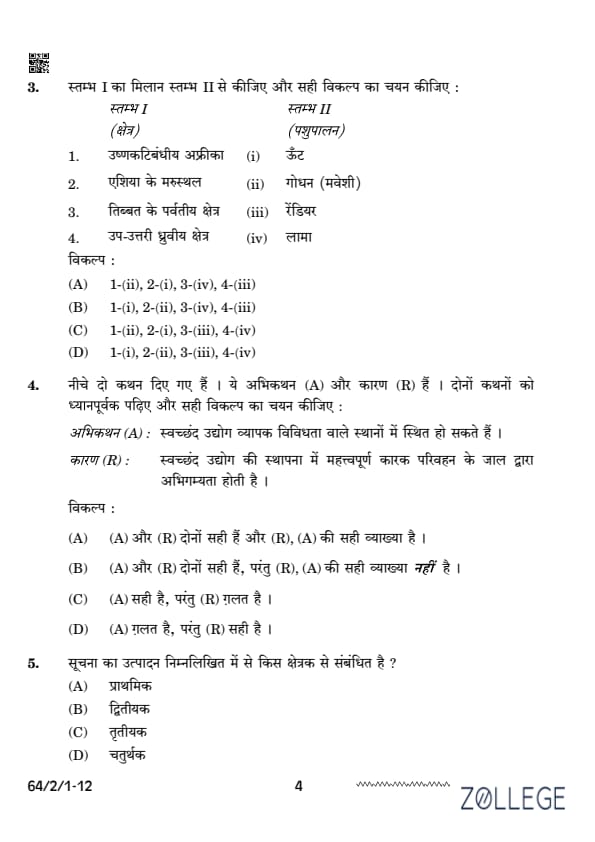
Question 3:
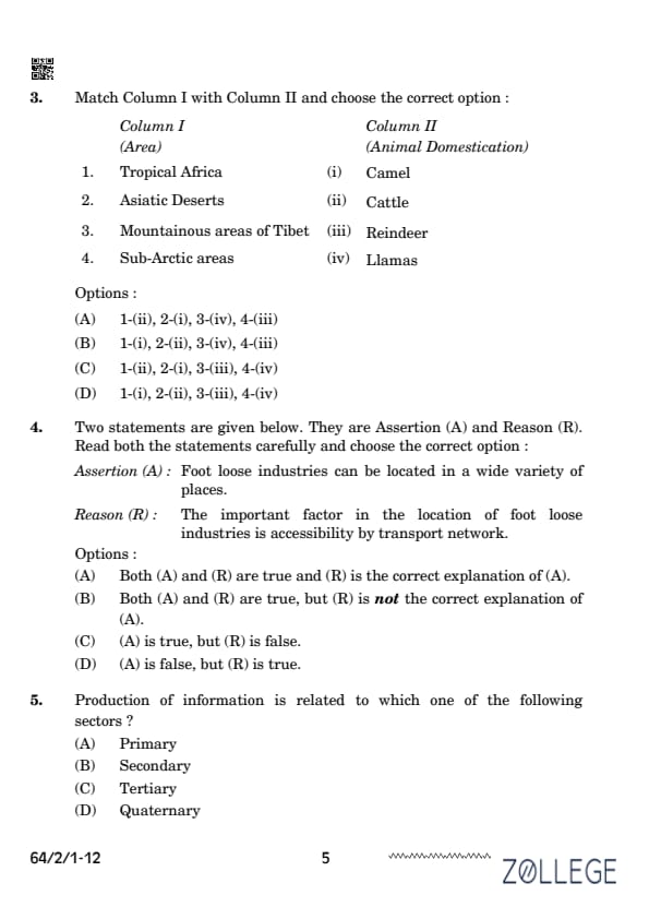
Match Column I with Column II and choose the correct option:
| Column I (Area) | Column II (Animal Domestication) |
|---|---|
| 1. Tropical Africa | (ii) Cattle |
| 2. Asiatic Deserts | (i) Camel |
| 3. Mountainous areas of Tibet | (iv) Llamas |
| 4. Sub-Arctic areas | (iii) Reindeer |
Correct Answer: (A) 1-(ii), 2-(i), 3-(iv), 4-(iii).
View Solution
The correct matches are as follows: 1. Tropical Africa - Cattle 2. Asiatic Deserts - Camel 3. Mountainous areas of Tibet - Llamas 4. Sub-Arctic areas - Reindeer These matches are based on the geographical and cultural practices of animal domestication in specific regions.
Question 4:
Assertion (A): Foot loose industries can be located in a wide variety of places. Reason (R): The important factor in the location of foot loose industries is accessibility by transport network.
Correct Answer: (A) Both (A) and (R) are true, and (R) is the correct explanation of (A).
View Solution
Footloose industries are industries that can be located in various locations without being tied to specific resources, such as raw materials, energy supply, or specific geographical factors. The critical factor for the location of such industries is accessibility through a robust transport network, which enables easy movement of raw materials and finished products to and from the industry. This is why the reason (R) correctly explains the assertion (A).
Question 5:
Production of information is related to which one of the following sectors?
Correct Answer: (D) Quaternary.
View Solution
The quaternary sector involves knowledge-based activities, including information production, research, and development. Examples include IT services, consultancy, and education.
Question 6:
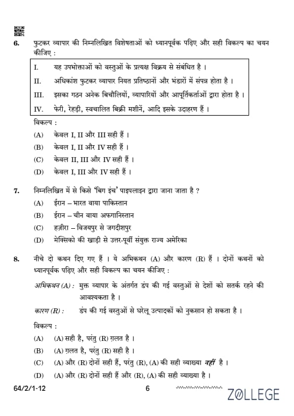
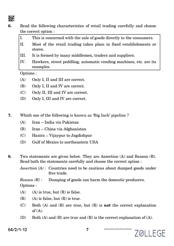
Read the following characteristics of retail trading carefully and choose the correct option: 1. This is concerned with the sale of goods directly to the consumers. 2. Most of the retail trading takes place in fixed establishments or stores. 3. It is formed by many middlemen, traders, and suppliers. 4. Hawkers, street peddling, automatic vending machines, etc., are its examples.
Correct Answer: (B) Only I, II and IV are correct.
View Solution
Retail trading involves selling goods directly to consumers (I). It is usually conducted in fixed stores or establishments (II). Examples of retail trading include hawkers, street peddling, and vending machines (IV). However, retail trading is not necessarily formed by multiple middlemen and traders, making statement III incorrect.
Question 7:
Which one of the following is known as the ‘Big Inch’ pipeline?
Correct Answer: (D) Gulf of Mexico to northeastern USA.
View Solution
The ‘Big Inch’ pipeline refers to a large oil pipeline system that transports petroleum from the Gulf of Mexico to the northeastern USA. It played a significant role during World War II by ensuring a steady supply of oil to the industrialized regions of the United States.
Question 8:
Two statements are given below. They are Assertion (A) and Reason (R). Read both the statements carefully and choose the correct option: Assertion (A): Countries need to be cautious about dumped goods under free trade. Reason (R): Dumping of goods can harm the domestic producers.
Correct Answer: (D) Both (A) and (R) are true and (R) is the correct explanation of (A).
View Solution
Dumping refers to selling goods in a foreign market at prices lower than their domestic value. This practice can harm domestic producers by undercutting local businesses, leading to market disruption. Thus, both statements are true, and (R) provides the correct explanation for (A).
Question 9:
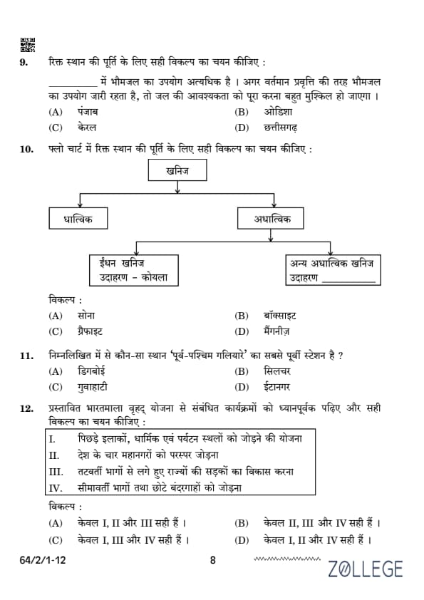
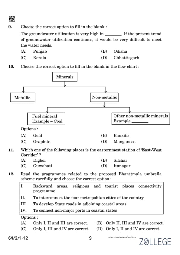
Choose the correct option to fill in the blank: The groundwater utilization is very high in __________. If the present trend of groundwater utilization continues, it would be very difficult to meet the water needs.
Correct Answer: (A) Punjab.
View Solution
Punjab faces a critical groundwater crisis due to excessive extraction for irrigation and agriculture. The groundwater table in this region has been depleting rapidly, making it challenging to sustain water needs in the future.
Question 10:
Choose the correct option to fill in the blank in the flow chart: Minerals -> Metallic, Non-metallic -> Fuel mineral, Example - Coal, Other non-metallic minerals, Example________

Correct Answer: (C) Graphite.
View Solution
Graphite is a non-metallic mineral commonly used in industries such as batteries, lubricants, and electrodes. It is an example of a non-metallic mineral, making it the appropriate choice for the given flow chart.
Question 11:
Which one of the following places is the easternmost station of the ‘East-West Corridor’?
Correct Answer: (B) Silchar.
View Solution
The ‘East-West Corridor’ is a major roadway network connecting Silchar in Assam (easternmost point) to Porbandar in Gujarat (westernmost point). Silchar serves as the easternmost station in this corridor.
Question 12:
Read the programmes related to the proposed Bharatmala umbrella scheme carefully and choose the correct option: 1. Backward areas, religious and tourist places connectivity programme 2. To interconnect the four metropolitan cities of the country 3. To develop State roads in adjoining coastal areas 4. To connect non-major ports in coastal states
Correct Answer: (C) Only I, III and IV are correct.
View Solution
The Bharatmala scheme primarily focuses on connecting backward areas, religious/tourist sites (I), developing state roads in coastal areas (III), and linking non-major ports (IV). Interconnecting the four metropolitan cities (II) is not a component of this scheme.
Question 13:
‘Swachh Bharat Mission’ has been launched by which one of the following?
Correct Answer: (B) Government of India.
View Solution
The ‘Swachh Bharat Mission’ was launched by the Government of India in 2014 to improve sanitation and eliminate open defecation across the country. This initiative focuses on building toilets and creating awareness about hygiene and cleanliness.
Question 14:
Which one of the following diseases is caused by water pollution?
Correct Answer: (A) Hepatitis.
View Solution
Hepatitis, particularly Hepatitis A and E, can be caused by consuming contaminated water. Waterborne diseases often result from the presence of pathogens in unclean or untreated water supplies.

Question 15:
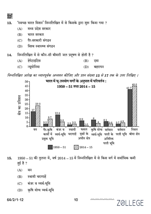
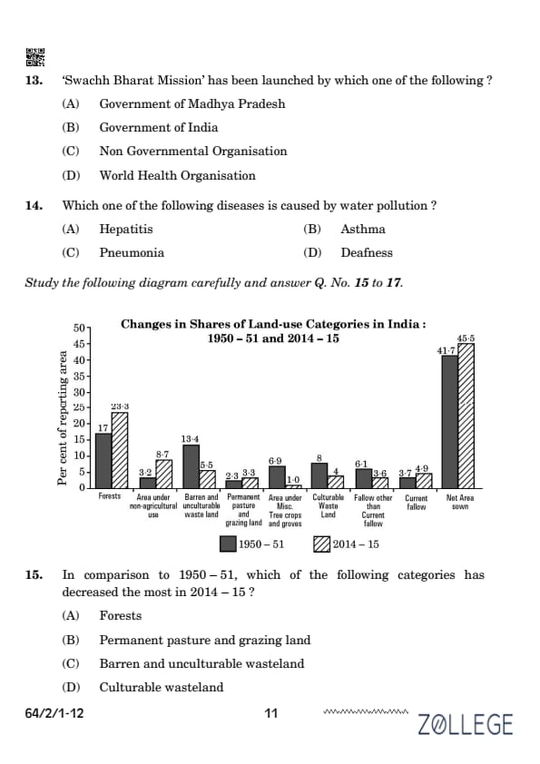
In comparison to 1950–51, which of the following categories has decreased the most in 2014–15? [Image of a bar chart showing land use percentages for different categories in 1950-51 and 2014-15.]
Correct Answer: (C) Barren and unculturable wasteland.
View Solution
From the given chart, it is evident that the share of barren and unculturable wasteland has significantly decreased from 13.4% in 1950–51 to 5.5% in 2014–15. This reduction indicates the conversion of such land into usable forms.
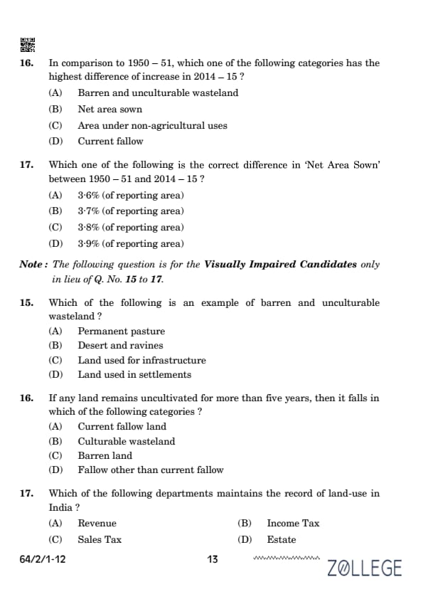
Question 16:
In comparison to 1950–51, which one of the following categories has the highest difference of increase in 2014–15? [Image of a bar chart showing land use percentages for different categories in 1950-51 and 2014-15.]
Correct Answer: (C) Area under non-agricultural uses
View Solution
The increase in non-agricultural land use reflects urbanization and industrial growth over the decades.
Question 17:
Which one of the following is the correct difference in ‘Net Area Sown’ between 1950–51 and 2014–15? [Image of a bar chart showing land use percentages for different categories in 1950-51 and 2014-15.]
Correct Answer: (C) 3.8% (of reporting area).
View Solution
The net area sown increased by 3.8% from 1950–51 to 2014–15, as per the given data. This increase highlights the efforts to bring more land under cultivation.
Question 15 (for Visually Impaired Candidates):
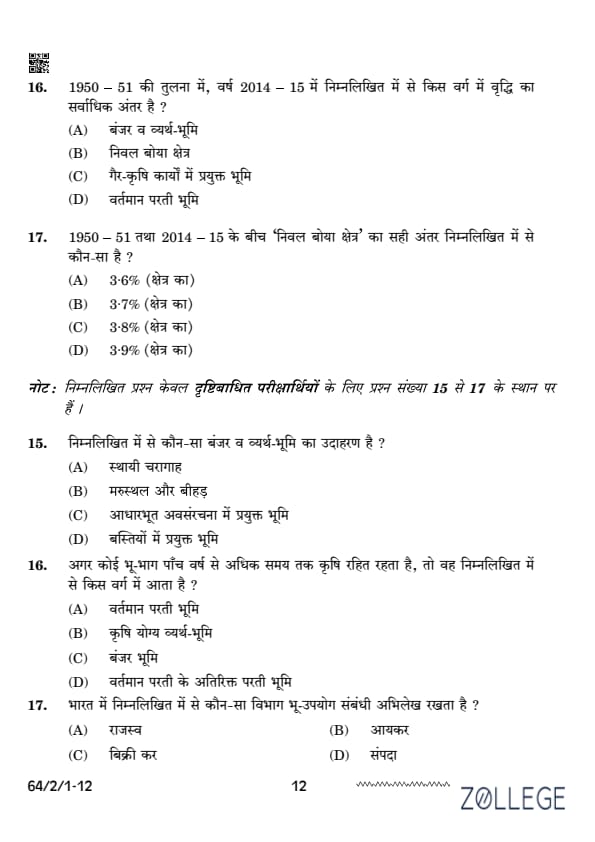
Which of the following is an example of barren and unculturable wasteland?
Correct Answer: (B) Desert and ravines.
View Solution
Barren and unculturable wasteland includes land types like deserts and ravines, which are not suitable for agricultural or other productive uses due to their unfavorable conditions.
Question 16 (for Visually Impaired Candidates):
If any land remains uncultivated for more than five years, then it falls in which of the following categories?
Correct Answer: (C) Barren land
View Solution
Land uncultivated for more than five years falls into the ”Barren Land” category as it becomes permanently unsuitable for cultivation.
Question 17 (for Visually Impaired Candidates):
Which of the following departments maintains the record of land-use in India?
Correct Answer: (A) Revenue.
View Solution
The Revenue Department is responsible for maintaining records of land-use in India. These records are essential for administrative purposes, taxation, and planning.
SECTION B
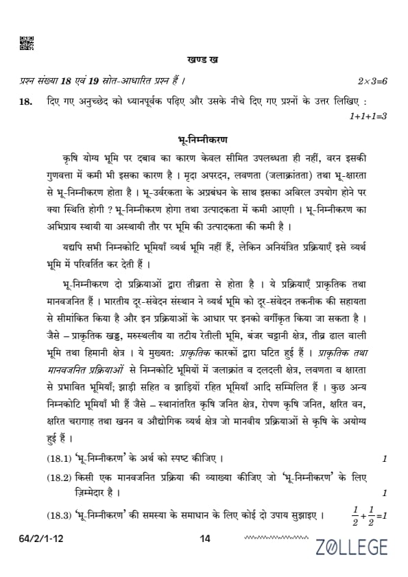
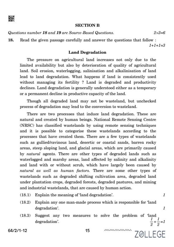
(1) The pressure on agricultural land increases not only due to the limited availability but also by deterioration of quality of agricultural land. Soil erosion, waterlogging, salinisation and alkalinisation of land lead to land degradation.
(2) What happens if land is consistently used without managing its fertility? Land is degraded and productivity declines. Land degradation is generally understood either as a temporary or a permanent decline in productive capacity of the land. Though all degraded land may not be wasteland, unchecked processes of degradation may lead to the conversion to wasteland.
Read More
(3) There are two processes that induce land degradation. These are natural and created by human beings. National Remote Sensing Centre (NRSC) has classified wastelands by using remote sensing techniques, and it is possible to categorise these wastelands according to the processes that have created them.
(4) There are a few types of wastelands such as gullied/ravinous land, desertic or coastal sands, barren rocky areas, steep sloping land, and glacial areas, which are primarily caused by natural agents. There are other types of degraded lands such as waterlogged and marshy areas, land affected by salinity and alkalinity, and land with or without scrub, which have largely been caused by natural as well as human factors.
(5) There are some other types of wastelands such as degraded shifting cultivation areas, degraded land under plantation crops, degraded forests, degraded pastures, and mining and industrial wastelands that are caused by human action.
Question 18.1:
Explain the meaning of ‘land degradation’.
View Solution
Correct Answer: Land degradation refers to the decline in the productive capacity of land due to natural processes or human activities. It is a temporary or permanent reduction in the quality of soil, vegetation, and land usability.
Question 18.2:
Explain any one man-made process which is responsible for ‘land degradation’.
Correct Answer: One man-made process responsible for land degradation is deforestation.
View Solution
The removal of trees and vegetation leads to soil erosion, loss of fertility, and an increase in barren land. Deforestation is often caused by agricultural expansion, logging, or infrastructure development.Question 18.3:
Suggest any two measures to solve the problem of ‘land degradation’.
Correct Answer: Two measures to solve the problem of land degradation are:
View Solution
1. Afforestation and Reforestation: Planting trees can stabilize soil, prevent erosion, and improve the land’s fertility. 2. Soil Conservation Techniques: Methods like terracing, contour plowing, and the use of cover crops help in reducing soil erosion and retaining soil fertility.Question 19.1:
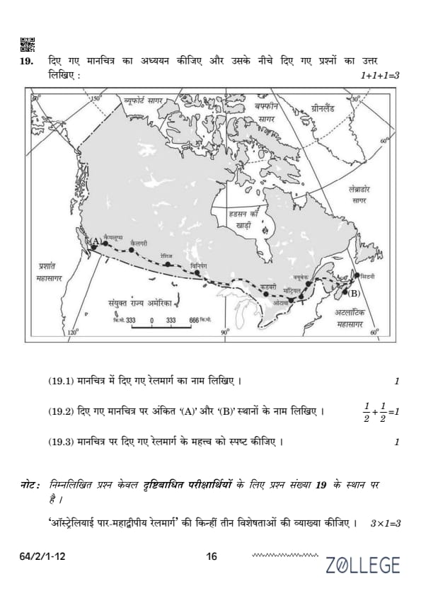
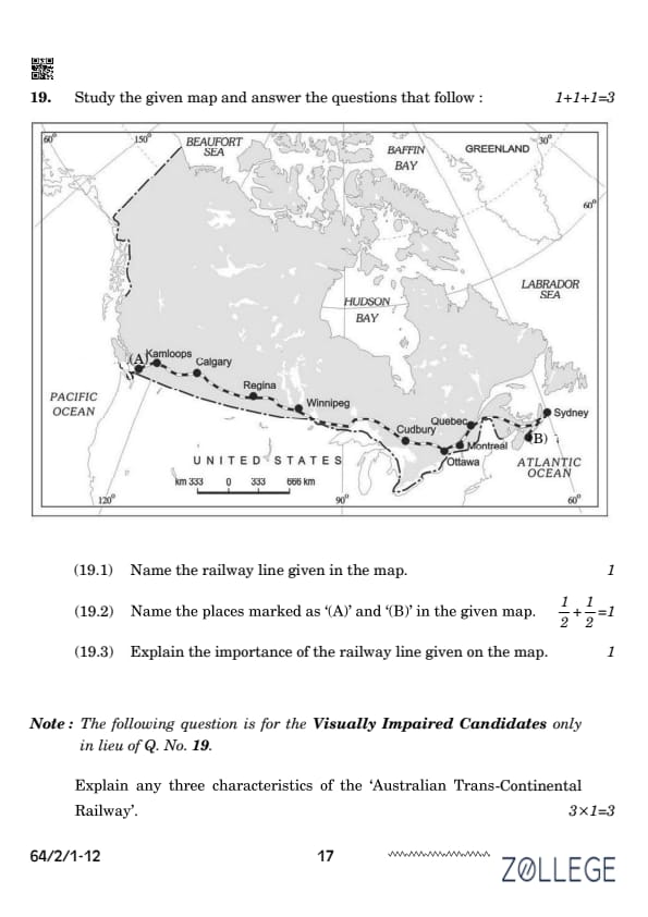
Name the railway line given in the map.
View Solution
Correct Answer: The railway line shown in the map is the Canadian Pacific Railway.
Question 19.2:
Name the places marked as ‘A’ and ‘B’ in the given map.
View Solution
Correct Answer: A: Kamloops (Western Canada) B: Sydney (Eastern Canada)
Question 19.3:
Explain the importance of the railway line given on the map.

Correct Answer: The Canadian Pacific Railway is significant because:
View Solution
1. It connects the eastern and western parts of Canada, promoting national integration. 2. It facilitates the movement of goods and passengers across the country. 3. It boosts trade and economic development by linking industrial hubs with resource-rich areas.SECTION C
Question 20(a):
How has the use of technology helped people to overcome nature’s obstacles? Analyse.
Correct Answer: Technology has significantly helped humans overcome natural obstacles by:
View Solution
1. Improving Accessibility: Technologies like bridges, tunnels, and railways have made previously inaccessible terrains reachable. 2. Agricultural Advancements: Irrigation, fertilizers, and machinery have enabled farming in arid and difficult regions. 3. Weather Predictions: Satellites and forecasting systems help mitigate disasters like cyclones and floods.Question 20(b):
How does neo-determinism try to achieve balance between two concepts of man–environment relationship? Analyse.
Correct Answer: Neo-determinism, or stop-and-go determinism,
View Solution
balances environmental determinism and possibilism by: 1. Guided Development: Encourages development within ecological limits. 2. Human Innovation: Supports human creativity to adapt responsibly to environmental constraints. 3. Sustainable Practices: Emphasizes coexistence and sustainable resource use.Question 21:
Explain, with examples, any three economic factors affecting population distribution in the world.
Correct Answer: 1. Employment Opportunities:
View Solution
Regions with industrial and commercial hubs, such as urban centers, attract large populations. Example: New York City. 2. Economic Stability: Areas with higher incomes and better living standards, like Western Europe, have denser populations. 3. Agricultural Productivity: Fertile plains like the Ganga Basin in India support dense rural populations.Question 22:
Explain any three basic differences between rural and urban settlements in India.
Correct Answer: 1. Population Density:
View Solution
Rural areas have low population density, while urban areas are densely populated. 2. Occupations: Rural areas focus on agriculture and allied activities; urban areas emphasize industry and services. 3. Infrastructure: Urban settlements have better transportation, healthcare, and education facilities compared to rural settlements.Question 23(a):
“The ways to measure human development are constantly being refined.” Support the statement with suitable arguments.
View Solution
Correct Answer: 1. Expanding Indicators: Beyond income, indices like HDI now include education, health, and living standards. 2. Focus on Equity: New measures account for gender inequality and multidimensional poverty. 3. Dynamic Metrics: Data integration from technology, such as satellite imagery, enhances precision.
Question 23(b):
“Equity refers to making equal access to opportunities available to everybody.” Support the statement with suitable arguments.
View Solution
Correct Answer: 1. Social Justice: Equity ensures all sections of society, including marginalized groups, have fair access to resources. 2. Economic Growth: A balanced distribution of opportunities leads to inclusive economic development. 3. Empowerment: Education and healthcare access for all empower individuals to contribute productively.
SECTION D
Question 24(a):
Describe any five features of plantation agriculture in the world.
View Solution
Correct Answer: Plantation agriculture is a type of commercial farming where a single crop is grown on a large scale. The features are: 1. Mono-cropping: A single cash crop like tea, coffee, or rubber is cultivated extensively. 2. Export-oriented: Crops are mainly grown for export purposes to generate revenue. 3. High investment: Requires significant investment in machinery, fertilizers, and irrigation. 4. Skilled labor: Employs both skilled and unskilled laborers for various tasks. 5. Large estates: Plantations are generally spread over large tracts of land, often owned by corporations.
Question 24(b):
Describe any five features of extensive commercial grain farming in the world.
View Solution
Correct Answer: Extensive commercial grain farming involves large-scale production of grains. The features are: 1. Large landholdings: Practiced over vast areas, mainly in temperate grasslands. 2. Mechanized farming: Uses advanced machinery for sowing, harvesting, and storage. 3. Low labor input: Relies on machines rather than manual labor. 4. Export-oriented: Produces surplus grain for export markets. 5. Climatic dependency: Requires specific climatic conditions like moderate rainfall and long growing seasons.
Question 25:
Explain the difference between cottage and large-scale industries in the world, with examples.
View Solution
Correct Answer: • Cottage Industries: – Small-scale, home-based industries. – Use simple tools and manual labor. – Examples: Handloom weaving, pottery, and embroidery. • Large-scale Industries: – Involve mass production using advanced machinery. – Require significant capital investment and infrastructure. – Examples: Automobile manufacturing, steel production.
Question 26(a):
Analyze the major problems of youth population in India. Suggest two measures to overcome the problems.
View Solution
Correct Answer: Major problems: 1. Unemployment: Limited job opportunities for a growing population. 2. Skill gap: Lack of vocational training and industry-relevant skills. 3. Mental health issues: Rising stress and anxiety levels due to competition. 4. Substance abuse: Increasing cases of addiction among youth. 5. Social inequality: Disparities in access to education and healthcare. Measures to overcome problems: 1. Skill development: Implement vocational training programs to bridge the skill gap. 2. Job creation: Encourage entrepreneurship and startups to generate employment.
Question 26(b):
How is discrimination on the basis of gender a crime against humanity? Suggest two measures to overcome the problem.
View Solution
Correct Answer: Gender discrimination involves unequal treatment based on gender, violating basic human rights. • Denies women equal access to education, employment, and healthcare. • Leads to social and economic inequalities. • Perpetuates violence and abuse against women. Measures to overcome the problem: 1. Awareness campaigns: Educate people about gender equality and women’s rights. 2. Legislation: Strictly enforce laws against gender discrimination and violence.
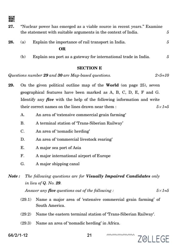
Question 27:
”Nuclear power has emerged as a viable source in recent years.” Examine the statement with suitable arguments in the context of India.
Correct Answer: • Low emissions:
View Solution
Nuclear energy generates power without greenhouse gas emissions. • High efficiency: Produces large amounts of energy from a small amount of fuel. • Energy security: Reduces dependence on fossil fuels and enhances energy security. • Challenges: High initial investment and concerns over nuclear waste management. • Example: India has 22 operational nuclear reactors contributing to clean energy.Question 28(a):
Explain the importance of rail transport in India.
View Solution
Correct Answer: Rail transport plays a significant role in India: 1. Connectivity: Connects remote regions to urban centers. 2. Economic growth: Facilitates trade and commerce by transporting goods efficiently. 3. Affordable travel: Provides cost-effective travel options for millions. 4. Employment: Employs a large workforce, directly and indirectly. 5. Environmental benefits: Reduces road congestion and pollution.
Question 28(b):
Explain sea port as a gateway for international trade in India.
View Solution
Correct Answer: Sea ports serve as vital hubs for international trade: 1. Export-import activities: Handle the majority of India’s international trade volume. 2. Economic growth: Contribute significantly to GDP through trade revenue. 3. Employment: Generate employment in port-related activities. 4. Infrastructure: Equipped with modern facilities for cargo handling and storage. 5. Global connectivity: Link India to international markets and trading partners.
SECTION E
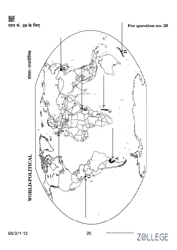
Question 29:
On the given political outline map of the World, identify any five of the following features and write their correct names on the lines drawn near them: [Image of an outline map of the world.]
Correct Answer: 
View Solution
• A: An area of ‘extensive commercial grain farming’ – The Prairies, USA.
• B: A terminal station of ‘Trans-Siberian Railway’ – Vladivostok, Russia.
• C: An area of ‘nomadic herding’ – Sahara Desert, Africa.
• D: An area of ‘commercial livestock rearing’ – Pampas, Argentina.
• E: A major sea port of Asia – Shanghai, China.
• F: A major international airport of Europe – Heathrow, London.
• G: A major shipping canal – Suez Canal, Egypt.
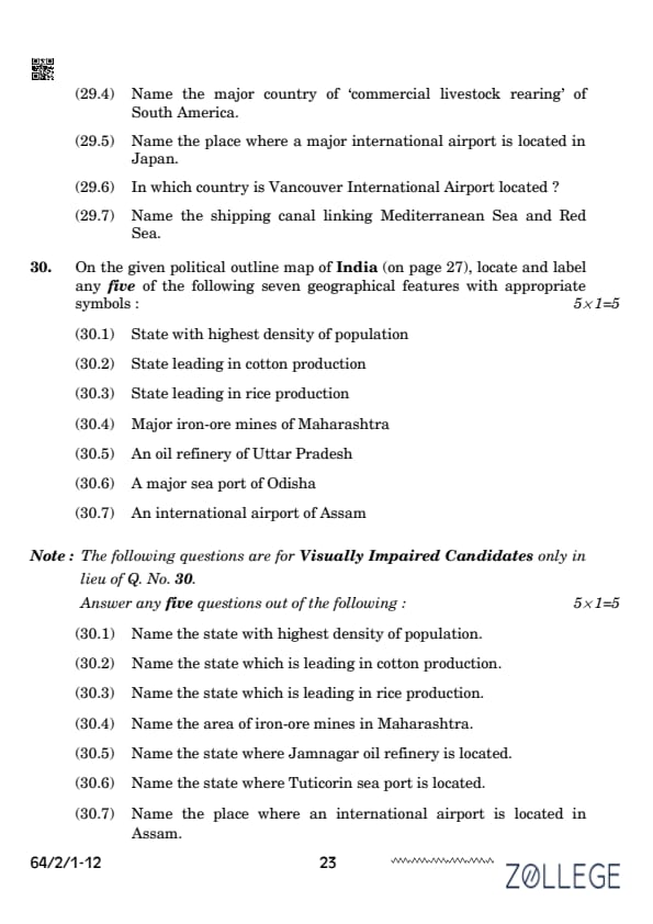
Question 29.1 (for Visually Impaired Candidates):
Name a major area of ‘extensive commercial grain farming’ of South America.
View Solution
Correct Answer: The Pampas, Argentina.
Question 29.2 (for Visually Impaired Candidates):
Name the eastern terminal station of ‘Trans-Siberian Railway’.
View Solution
Correct Answer: Vladivostok, Russia.
Question 29.3 (for Visually Impaired Candidates):
Name an area of ‘nomadic herding’ in Africa.
View Solution
Correct Answer: Sahara Desert, Africa.
Question 29.4 (for Visually Impaired Candidates):
Name an area of ‘commercial livestock rearing’ in Australia.
View Solution
Correct Answer: The Australian Downs.
Question 29.5 (for Visually Impaired Candidates):
Name a major sea port of Asia.
View Solution
Correct Answer: Shanghai, China.
Question 29.6 (for Visually Impaired Candidates):
Name a major international airport of Europe.
View Solution
Correct Answer: Heathrow Airport, London.
Question 29.7 (for Visually Impaired Candidates):
Name a major shipping canal.
View Solution
Correct Answer: Suez Canal, Egypt.
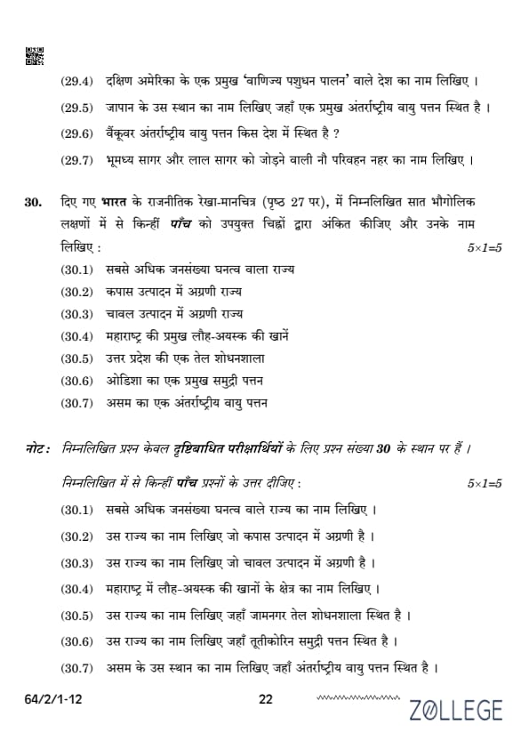
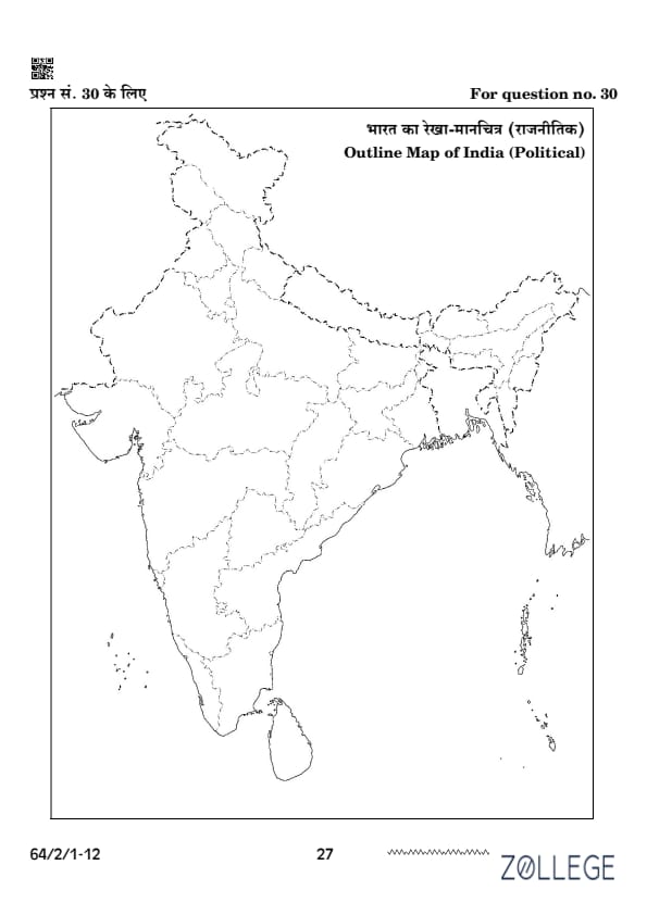
Question 30:
On the given political outline map of India, locate and label any five of the following seven geographical features with appropriate symbols: [Image of a political map of India.]
View Solution
Correct Answer: • 30.1 State with highest density of population: Bihar. • 30.2 State leading in cotton production: Gujarat. • 30.3 State leading in rice production: West Bengal. • 30.4 Major iron-ore mines of Maharashtra: Chandrapur. • 30.5 An oil refinery of Uttar Pradesh: Mathura Refinery. • 30.6 A major sea port of Odisha: Paradip Port. • 30.7 An international airport of Assam: Lokpriya Gopinath Bordoloi International Airport (Guwahati).
Question 30.1 (for Visually Impaired Candidates):
State with highest density of population: Bihar.
View Solution
Correct Answer: Bihar.
Question 30.2 (for Visually Impaired Candidates):
State leading in cotton production: Gujarat.
View Solution
Correct Answer: Gujarat.
Question 30.3 (for Visually Impaired Candidates):
State leading in rice production: West Bengal.
View Solution
Correct Answer: West Bengal.
Question 30.4 (for Visually Impaired Candidates):
Major iron-ore mines of Maharashtra: Chandrapur.
View Solution
Correct Answer: Chandrapur.
Question 30.5 (for Visually Impaired Candidates):
State where Jamnagar oil refinery is located: Gujarat.
View Solution
Correct Answer: Gujarat.
Question 30.6 (for Visually Impaired Candidates):
State where Tuticorin sea port is located: Tamil Nadu.
View Solution
Correct Answer: Tamil Nadu.
Question 30.7 (for Visually Impaired Candidates):
Place where an international airport is located in Assam: Guwahati.
View Solution
Correct Answer: Guwahati.


*The article might have information for the previous academic years, please refer the official website of the exam.